|
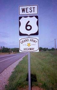
The Grand Army of the Republic (Memorial)
Highway
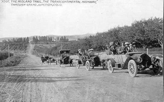
(The King's Highway, Roosevelt Highway, and the Midland Trail, etc.)
The Grand Army of the Republic (Memorial) Highway is the
present official name, however, during the late 20s and early 30s it was also known as the
Roosevelt Highway, after President Theodore Roosevelt. Prior to 1926 it was called
(in-part) the Midland Trail Roadway.
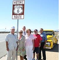
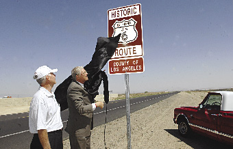
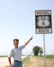
The Historic
Highway began as an entity in November of 1926 when the American
Association of State Highway Officials (AASHO) adopted the U.S.
numbering system for marking the Nation's main Interstate highways.
The Grand Army of the Republic (Memorial) Highway is the
present official name, however, during the late 20s and early 30s it was also known as the
Roosevelt Highway, after President Theodore Roosevelt. Prior to 1926 it was called
(in-part) the Midland Trail Roadway.
The Historic
Highway began as an entity in November of 1926 when the American
Association of State Highway Officials (AASHO) adopted the U.S.
numbering system for marking the Nation's main Interstate highways. Historic U.S. Route
6 --- Coast-to-Coast Through 14 States
At this point,
U.S. Route 6 was still just a patchwork of mis-matched highways. Writer/Historian George
R. Stewart commented that, "Route 6 runs uncertainly from nowhere to nowhere,
scarcely to be followed from one end to the other, except by some devoted eccentric."
However, it lost its transcontinental status in 1965 when AASHO approved a request from
the State of California to end the Historic Highway at the Town of Bishop. Currently, U.S.
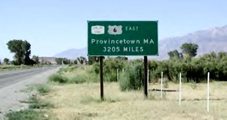
Route 6 is 3,227* miles long, making it the second longest U.S. Route in the country. U.S.
Route 20 is now classified as the longest route at 3,345* miles. Much of the original
alignment remains intact between Bishop and Long Beach, California. I can only hope that,
someday, the State of California will properly post these remaining portions of this
famous Highway.
The West End Question
Over the years there have
been several different west endings to Historic U.S. Route 6, and all were located in the
City of Long Beach, California. The big question is, at which location did it actually
end? Our archives reveal the following three documented endings.
Prior to 1953 the
Historic Highway ended at the east end of town, at the Long Beach Traffic Circle.
In 1953 Route 6 ended at
the water front at the Long Beach Municipal Auditorium. It was here that the Grand Army of
the Republic Association(G.A.R.) held an official U.S. Route 6 Encampment. A bronze plaque
was placed on the outside of the wall of the Auditorium which identified this location as
the westerly end of U.S. Route 6. The Auditorium was located at the intersection of what
is now Long Beach, Blvd. (Old Route 6) and Seaside Blvd.
As an item of interest,
the Long Beach City Council officially authorized the placing of temporary U.S. Route 6
signs along Long Beach Blvd. in order to direct G.A.R. encampment traffic to the
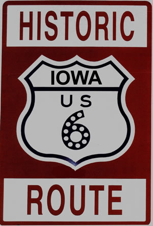
auditorium. Because of this, U.S. Route 6 is officially known as The Grand Army of the
Republic Highway.
Prior to 1953 it is said that the West End was in Wilmington at the intersection of Figueroa Street and the Pacific Coast Highway. However, we have no documents to support this as a fact. (back to researching the archives)
For additional information about the West End
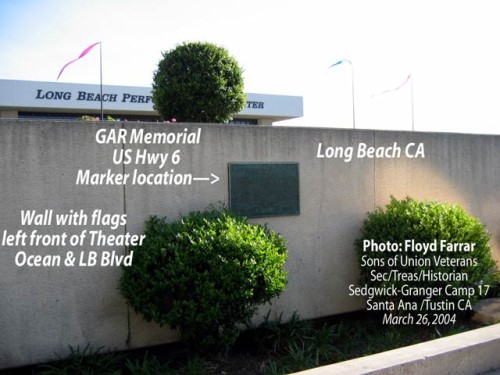
Historic US 6 Highway ends in Long Beach CA
So where is the location
of the bronze plaque today?
After
the Municipal Auditorium was torn down in the 60s, a monument marking the west end of the
Historic Highway was relocated on the wall of the Terrace Theater, located on the south
side of Ocean Blvd.
On January 23, 2001 the
Association received a letter from the Historical Society of Long Beach which informed us
that the plaque is now located on Ocean Boulevard near the Long Beach Performing Arts
Center, formerly known as the Terrace Theater.
Should anyone reading
this text have any questions, or knows of any other historical facts about the west end of
Route 6, I would appreciate hearing form you.
Russ Lombard, President
U.S. Route 6 Tourist Association
08/2001
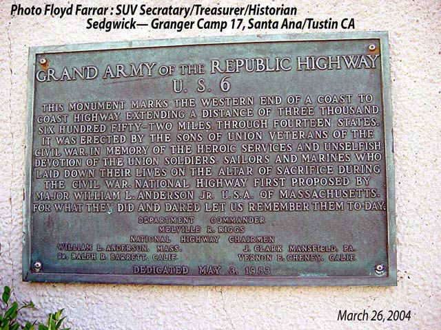
PLAQUE AT THE WEST END
( Pictures Taken - March 26, 2004)
Thanks to the Historical Society of Long Beach, California,
and to Floyd Farra, Historian with the Sons of Union Vetrans,
we now know the current location and have some pictures of the
Plaque which established the West End of Historic U.S. Route
6 on May 3, 1953. The Plaque is located on the wall in front
of the Long Beach Performing Arts Center at Ocean and Long Beach
Boulevard.
The Historical
Society of Long Beach
 The Plaque The Plaque
On the wall
|