Connecticut Portion of US Route 6

The  Connecticut Portion of US Route 6 takes travelers along a scenic 116.3 mile (187.2 km) journey through Connecticut, beginning at the border with New York and ending at Rhode Island state line in Killingly – passing right by Danbury and Hartford as it goes! In western sections of The Constitution State, US 6 is close to I-84; while eastern portions offer access between Providence R.I., Willimantic & Danielson toward bustling downtown Hartford via CT’s historic Bulkeley Bridge over the gorgeous Connecticut River!

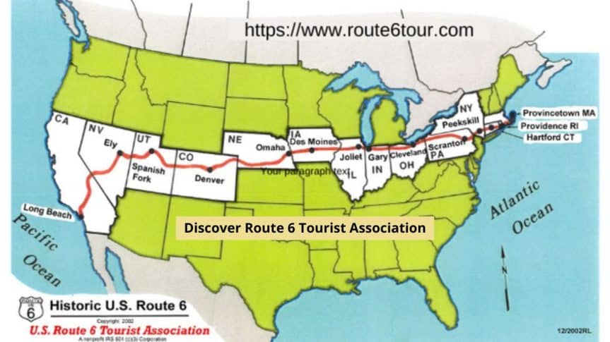
Established as a National 501(c)(3) charitable organization, as a Public Charity the U.S. Route 6 Tourist Association works to promote economic development and cultural preservation for communities located along “The Grand Army of The Republic Highway.” Spanning 3,652 miles in total, this grand old highway is an integral part of Americana with many sites rich in history waiting to be discovered!  Online at https://www.route6tour.com

Iowa Portion of US Route 6 post

Connecticut Links

Connecticut Links a list of communities on or near US Route 6

Now updated with Google Maps symbol for location designation


Andover - Google Maps Andover Andover
Bethel - Google Maps Bethel Bethel
Bolton Notch - Google Maps Bolton Notch Bolton Notch
Bristol - Google Maps Bristol Bristol
American Clock & Watch Museum in Bristol - Google Maps American Clock & Watch Museum in Bristol American Clock & Watch Museum in Bristol
The Carousel Museum in Bristol - Google Maps The Carousel Museum in Bristol The Carousel Museum in Bristol
Brooklyn - Google Maps Brooklyn Brooklyn
East Brooklyn - Google Maps East Brooklyn East Brooklyn
Burnside - Google Maps Burnside Burnside
Clarks Corner - Google Maps Clarks Corner Clarks Corner
Cobalt - Google Maps Cobalt Cobalt
Columbia - Google Maps Columbia Columbia
Coventry - Google Maps Coventry Coventry
Danbury - Google Maps Danbury Danbury
Greater Danbury Business Association - Google Maps Greater Danbury Business Association Greater Danbury Business Association
Danielson - Google Maps Danielson Danielson
Dodgington - Google Maps Dodgington Dodgington
Farmington - Google Maps Farmington Farmington
Farmington Valley Chamber - Google Maps Farmington Valley Chamber Farmington Valley Chamber
Farmington River - Google Maps Farmington River Farmington River
Hampton - Google Maps Hampton Hampton
City of Hartford - Google Maps City of Hartford City of Hartford
West Hartford Region Economic Development - Google Maps Hartford Region Economic Development Hartford Region Economic Development
Mark Twain House in Hartford - Google Maps Mark Twain House in Hartford Mark Twain House in Hartford
East Hartford - Google Maps East Hartford East Hartford
East Hartford Chamber of Commerce - Google Maps East Hartford Chamber of Commerce East Hartford Chamber of Commerce
West Hartford - Google Maps West Hartford West Hartford
West Hartford Chamber of Commerce - Google Maps West Hartford Chamber of Commerce West Hartford Chamber of Commerce
Noah Webster House - Google Maps Noah Webster House Noah Webster House
Hebron - Google Maps Hebron Hebron
Hebron Historical Society Hebron Historical Society
The Airline Trail - Google Maps The Airline Trail The Airline Trail
Hop River State Park Trail - Google Maps Hop River State Park Trail Hop River State Park Trail
Killingly - Google Maps Killingly Killingly
Manchester - Google Maps Manchester Manchester
Greater Manchester Chamber Of Commerce - Google Maps Greater Manchester Chamber Of Commerce Greater Manchester Chamber Of Commerce
Manchester Historical Society - Google Maps Manchester Historical Society Manchester Historical Society
Marion - Google Maps Marion Marion
Marlborough - Google Maps Marlborough Marlborough
Meriden - Google Maps Meriden Meriden
Meriden Chamber of Commerce - Google Maps Meriden Chamber of Commerce Meriden Chamber of Commerce
Middletown - Google Maps Middletown Middletown
Middletown History Middletown History
Downtown Middletown - Google Maps Downtown Middletown Downtown Middletown
Mill Plain - Part of Fairfield - Google Maps Mill Plain – Part of Fairfield Mill Plain – Part of Fairfield
Minortown - Google Maps Minortown Minortown
Newtown - Google Maps Newtown Newtown
Chamber of Commerce of Newtown - Google Maps Chamber of Commerce of Newtown Chamber of Commerce of Newtown
History of Oakland Gardens History of Oakland Gardens
Pequabuck Tunnel -Terryville Railroad Tunnel - Google Maps Pequabuck Tunnel Pequabuck Tunnel
Pequabuck River - Google Maps Pequabuck River Pequabuck River
Plainville - Google Maps Plainville Plainville
Plymouth - Google Maps Plymouth Plymouth
Pomperaug Regional High School - Google Maps Pomperaug Regional High School Pomperaug Regional High School
Portland - Google Maps Portland Portland
Portland Brownstone Quarries - Google Maps Portland Brownstone Quarries Portland Brownstone Quarries
Reynolds Ridge - Google Maps Reynolds Ridge Reynolds Ridge
Sandy Hook - Google Maps Sandy Hook Sandy Hook
Southbury - Google Maps Southbury Southbury
Terryville - Google Maps Terryville Terryville
Thomaston - Google Maps Thomaston Thomaston
Waterbury - Google Maps Waterbury Waterbury
Mattatuck Museum in Waterbury - Google Maps Mattatuck Museum in Waterbury Mattatuck Museum in Waterbury
Watertown - Google Maps Watertown Watertown
Watertown History Museum - Google Maps Watertown History Museum Watertown History Museum
Willimantic - Google Maps Willimantic Willimantic
North Windham History North Windham History
Woodbury - Google Maps Woodbury Woodbury
North Woodbury - Google Maps North Woodbury North Woodbury

Happenings, not yet?

Visit the link for Happenings at the top menu, details are available there to add your happening in your Route 6 state.

Become aSponsor Route 6