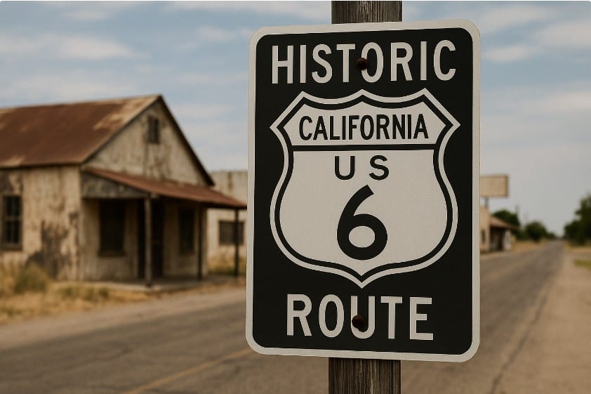
In its original form (prior to 1964), U.S. Route 6 stretched all the way to Long Beach,
California, making it the longest highway in the country. However, a major
renumbering of California’s state highways in 1964 truncated the route, ending it at
Bishop, according to the US Route 6 Tourist Association. The state legislature
recognized the historical significance of the decommissioned section, allowing
“Historic US 6” signage to be placed along the old alignment.
While some sections of old Route 6 are now incorporated into other modern routes
like U.S. 395, State Route 14 (SR 14), and Interstates 5 and 110, there are sections
that have been forgotten or are less traveled today.
Here are some potential forgotten landmarks and aspects of the original Route 6 in
California:
Roadside Oddities and Businesses: Along the original path, many small towns and
businesses likely thrived due to the traffic Route 6 brought. These might include old motels,
diners, gas stations, and other structures that have since been abandoned or repurposed.
Segment of the Arroyo Seco Parkway: The original alignment of US 6 included a segment
of the Arroyo Seco Parkway, says Wikipedia. This historic parkway, a precursor to modern
freeways, offers a glimpse into early automotive travel in Southern California.
Towns impacted by the Interstate System: The construction of the Interstate Highway
System in the 1950s and 60s diverted traffic from many towns along historic routes, including
Route 6. The original paths through some of these communities might contain remnants of the
old highway and associated infrastructure.
Remnants of Older Alignments: Like other historic highways, Route 6 likely had different
alignments throughout its history. Finding sections of these older alignments, particularly those
that are less obvious today, could be considered finding forgotten landmarks.
The “End of Route 6” Marker in Long Beach: While the current terminus is Bishop, the
original end point in Long Beach likely had a marker or sign to commemorate the route’s
incredible journey. Locating the exact site or remnants of this marker would be a significant
discovery.
While not explicitly “forgotten,” Manzanar National Historic Site is a sobering and
important landmark along the route that may not be as widely recognized for its
connection to US 6 as it is for its historical significance as a WWII Japanese
internment camp.
Exploring the modern highways and smaller roads that incorporated parts of the
original Route 6, along with consulting historical maps and archives, could reveal
more about the specific forgotten landmarks along this once prominent cross-country
highway.
Social Media Links
1. Facebook https://www.facebook.com/groups/11546954214/posts/10162402999649215/
2. X(Twitter) https://x.com/route6tour/status/1954934147455328736
3. Linked In Community https://www.linkedin.com/posts/u-s-route-6-tourist-association_forgotten-california-landmarks-along-historic-activity-7360696472251564032-B4YS/
4. YouTube Community https://www.youtube.com/post/UgkxeQXTl-3SBqpi23xKTCzq5NqPFxIOBbrP
5. Reddit https://www.reddit.com/r/USRoute6/comments/1mnh2wa/before_1964_us_route_6_stretched_from_long_beach/
6. Pinterest Pin https://www.pinterest.com/pin/333336809939208948
7. Instagram https://www.instagram.com/p/DNOJFGhRarN/


